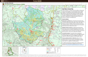
7/20 The BEAR team, working on the Pocket Fire, finished their field surveys of the burn area, which measures how badly each area was impacted by the fire. Their assessment shows 32% or just over 7,400-acres burned very low with 65% or 17,833-acres burning moderately and the remaining 3% or 876 acres burning severely. The more severely burned areas will see the most runoff through the remainder of the monsoon due to a lack of soil and ground cover to slow it down. The Pocket Fire SBS map can be downloaded from InciWeb at https://inciweb.wildfire.gov/incident-information/azcof-pocket-baer