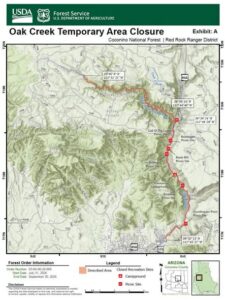
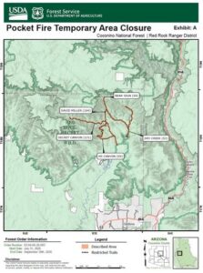
7/31 Coconino National Forest reduced the size of the Pocket Fire closure, in Oak Creek Canyon, north of Sedona. The Pocket Fire was officially declared 100% contained yesterday. Several locations in the canyon will remain closed for public safety and most of those locations are along Oak Creek and Highway-89A. The Pocket Fire started June 19-th and burned 27,393-acres. The cause of the fire has not been determined.
Certain areas, recreation sites, and trails that continue to be closed for public safety include:
- Banjo Bill Picnic Site
- Bear Sign Trail #59
- Bootlegger Picnic Site
- Call of the Canyon
- David Miller Trail #164
- Dry Creek Trail #52
- Encinoso Picnic Site
- Grasshopper Point Picnic Site
- Halfway Picnic Site
- HS Canyon Trail #50
- Manzanita Campground
- Oak Creek, beginning where the West Fork drainage meets the creek, then south to where it exits national forest land (within 100 feet of each side of the creek).
- Secret Canyon Trail #121
- West Fork Trail #108 (The entirety of the West Fork drainage from Forest Road 231, within 100 feet of each side of the drainage).
Official forest orders and maps can always be found on the Coconino National Forest Alerts web page at https://www.fs.usda.gov/r03/coconino/alerts